Tag

replacing

Browsing

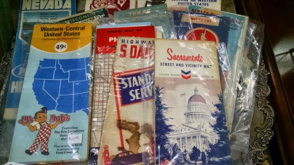
Google Maps has been out for 10 years now. Digital maps…starting with Mapquest has been out since 1996 (technically 1993 but mapquest was the first main stream map most people remember). For those of you keeping track that puts us almost 20 years into the digital mapping word. 20 years we have been using digital maps and yet for some reason digital maps have not replaced (there’s that word again) mapping in our schools.

In 2007…8 years ago now….Apple put a map in our pocket. Fast forward to 2015 and almost everyone has a digital map in their pocket. Pilots now fly with iPads, ship captains now navigate with GPS and digital maps. Truck drivers now drive via digital maps and GPS location. So basically every professional that needs to use maps is using digital maps. I’m not saying we need to stop teaching how to read a paper map…but really…that should be 10% of the mapping work a student does not 99%.

With that in mind here are 10 ways you could use Google Maps in the classroom.

1. Latitude Longitude Scavenger Hunts

gmaplogoYou remember learning about Latitude and Longitude right? Well, in a paper map world it’s a place that is “kind of there” where your two fingers meet. In a digital world it’s a specific location. This allows us to do some fun stuff and learn about Latitude and Longitude at the same time.

What do these three places have in common?

24.007233, 38.210118

31.204263, 121.281686

46.986944,-123.812859

Then maybe you have students go to the opposite hemisphere from where these places are and see what’s there. Is this math looking at x y axis and how we divide our world? Or is this social studies and looking at landmarks? Or is this English and we have the settings of the books we have read? Or is it History and we’re comparing and contrasting battle sites. In a digital mapping world Latitude and Longitude mean more than where your fingers meet…it’s a very exact location.

Google Sightseeing blog: View some of the great images from around the world

2. Earth Picker

earthpickerEarth Picker is a fun and addicting game. If you click on the link kiss the next 30 minutes of your life goodbye. The game reminds me a bit of Carmen Sandiego back in the day. Only in this game you need to be able to “read an image” a new skill that we need to be teaching students as more and more of our information becomes visual. What do you see? What clues can you find? A great little game to start teaching digital mapping skills.

Yes…Google does have a whole site dedicated to using maps in education

3. Smarty Pins

smartypinsSmarty Pins is a great game for educators to use and adapt. I encourage educators to play the game for awhile, yes the questions seem to be American Centric, however what we’re after here is the questions that Google is asking and how the game works. Once you get the hang of it an educator could create their own questions around their own content area. Students could put a pin on the map where they think it is…once the true place is revealed they could get driving directions to see how far they were off….now we bring math into the curriculum and have students add and keep track of their own distances. Think settings of books in English class, battles in history class, or create questions in a world language class and the country practicing language skills. Yes the game is fun….even better is how easy it would be to adapt it to fit your curriculum.

Create your own mapping game

4. My Maps

mymapsMy Maps is simply amazing. So much so that it is used in the next six ways to use Google Maps. My Maps allows you to create maps not just read and use them. All of a sudden we become digital map creators and the possibilities become endless.

5 ways to use My Maps in the classroom

5. Video Tour

mapvideoUsing My Maps students could add markers along a route of say…..Ferdinand Magellan. Students could create videos, or record their voice and actually embed them into a marker for others to learn about what happened at that spot on his travels.

Now….because this is Google…..of course you can share a map just like you can a Google Doc. Now you have 10 students working on 10 different explorers all of them adding their routes and videos to the same map. From there we can start to see patterns of routes, patterns of where explorers were going and what they were trying to do. Now we can start asking questions and as we find answers to them we create videos and add more information back to the world.

Want some training? No problem Google has you covered!

6. Create a map for your community

communitymapsMy Maps isn’t new. In fact I’ve been creating maps for different purposes since about 2007! Here’s a map that I created for friends that came to visit while we lived in Shanghai, China from 2005 – 2008. Are you studying your community? Your country? Your state/province? Why not create a map for others based on your favorite places to eat, visit, play, etc.

See how others are using Google Maps to help their communities

7. Create a route

vpqWe’re talking real skills here! Here’s a route I created when my wife and I visited Croatia last year. We had never been to Croatia before and didn’t know the roads or how long we should expect to drive between our destinations. Using My Maps we were able to create a route from hotel to hotel and get a really close approximation of the driving time we would have each day. So cool and digital maps has now forever changed the way you travel!

Keep up with what Google is doing with maps

8. Measure Distance and Area

googlemapsdistancesIn My Maps you get the ability to draw straight lines to see the distance between two points anywhere in the world. Better yet is the ability to draw out an area. Ever wonder just how big Russia really is? What if you draw an area map around your country and then move that area over Russia. How many of your countries do you think fit in Russia? In China? On the continent of Africa?

Using Google Maps in math class

9. See your World in 3D

googleearthMy Maps allows you to export your map in KML format. Funny….cause Google Earth allows you to import KML files to give you high resolution images of all your information in a 3D space. Expanding the conversation, expanding knowledge about our world…and beyond.

40+ Ways to Use Google Earth and Maps in the classroom

10. Mobile Maps

mymapslogoGoogle Maps is downloadable on every mobile device I know of and My Maps is as well (Android, iOS)! So now you can create maps and use maps on your phone, tablet, watch? No need to have a class set of laptops when every students has a phone in their pocket. Here’s the problem…..this is number 10 and now that we have the ability to make and read maps on a mobile device that has GPS on it…..we just opened up a whole new way to engage with information, create information, and teach students the skills they’ll need for their future in a digital mapping world!

Ideas of how to use My Maps on mobile devices

Maps I found in an antique shop. Yes...paper maps are now considered antiques.
Maps I found in an antique shop. Yes…paper maps are now considered antiques.

Yes…..paper maps days are numbered. Sure they’ll be around for awhile yet but really…that’s for our generations not theirs. They might never touch a paper map…never have to be frustrated with trying to fold it back up, worry about it ripping or whether or not it’s up to date. I know, I know….we loved our paper maps. But it’s time to let them go and embrace a new digital mapping world. For the sake of our students and their future.

Happy Birthday Google Maps….may you continue to lead me around our world!

300px eduro

There has been a lot going on with my new adventure that is Eduro Learning. Kim Cofino and I, along with 5 others, founded the company last May. The idea behind the company was that there were many conferences, summits, and PD opportunities to learn about technology tools however very few focused on the change in classroom culture that needs to happen or the change in the mindset of educators that needs to happen to truly take advantage of what technology has to offer.

It’s 2015 if you hadn’t noticed, and we’re still in a place where very rarely is technology replacing learning in the classroom in meaningful ways. I believe that’s because “integrate” is the wrong word…the wrong mindset. In 2015 we need to start thinking about replacing

What skills need to be replaced in our curriculum because of technology?

You see replacing is a different mindset. It’s a different way of looking at technology. We don’t have a lesson created already and try and integrate technology into it. No…we need to start replacing the whole lesson with something different because of the technology we have available to us.

We’re not talking about small changes here….we’re talking about shifting the way technology is viewed. Shifting the way technology is used and thought about.

Of course this culture shift needs to be understood by the administration. It needs to be more than we’re giving every student a laptop and move into a deeper question of how do we change the culture of our school?

MSD Logo_Only_MSOfficeI’m excited that we found a school district, an administrative team, and a staff hungry for a new way of looking at learning in 2015 and beyond. Eduro Learning has entered into a five year contract with Marysville School District in Washington State to do just that….to take 450+ educators through a program that changes the culture of the way learning happens (Press Release).

This goes beyond conferences, summits and institutes. Beyond one-off PD days and looks at long term embedded learning. Each educator who teaches 4th – 12th grade in Marysville will spend three years with the Eduro Team. This is the type of long term professional development that truly can change the culture of a school or district. Very few school boards and school leaders are willing to invest this type of money and resources into changing the culture of their school. Even fewer are willing to sell it to their community and make it happen. We’re looking for those type of schools, school boards, school leaders. Ones that truly understand that it’s 2015 and we need to start thinking differently about the tools available to us and look at how society operates with technology today and bring the education of students inline with the way technology is being utilized in our global society.

I have no doubt you’ll be hearing more about this project here and across the web as we get started in May.

Of course not every educator is lucky enough to work at a school district like this, so professional development opportunities in the form of institutes, conferences and summits is still the default way that schools support educator professionally.

Because of that we have been thinking how we take those opportunities and make them the best they possibly can be within the time frame we have.

How do we make institutes social, collaborative and in-depth?

It means moving away from a model of learning a lot of stuff and learning something really well. It’s moving away from 45 minute or 90 minute sit-and-get conference sessions to a full day of in-depth, interactive learning in a single strand.

Eduro Learning is launching four events starting this summer focused on in-depth, interactive professional development.

google-plus-profileSeattle, WA One-Day Institute:

The first thing you’ll notice when you head over to the event page is that you sign up for a strand within the institute. Yes…we make you chose what you want to spend a full day learning about. You do not go to this session or that session….you go to a full day, in-depth, interactive learning session on a given topic. The three strands will interact with each other and overlap their learning as social is a key component of learning for all ages.

Secondly you’ll notice that these are not big events. We’re keeping them at 150 people. Small, focused, intense learning sessions that allow us to differentiate the learning for the participants. When’s the last time you went to a conference or summit that tried to meet your specific needs as a professional learner?

Wired with Wine in Walla Walla Two-Day Institute:

This is my brainchild (OK….I give my wife 51% of the credit) and I’m excited to see if we can make this work. Why can’t educational professional development be fun? Be is beautiful locations and treat educators like adults and provide a little responsible fun with the learning?

The idea here is we spend two days going in-depth in learning while mixing in wine tasting in one of the great wine regions of Washington State. Learning is still the focus however, we’re infusing some fund wine tasting and wine knowledge into the learning experience. What if…for example we talk about how you can use a Google Form to collect data and get instantly results and then use that same approach in a blind wine tasting test to see which wine is viewed best by the participants. Not only do we talk about what you can do, we’ll actually do it…with wine of course. Once again making the institute interactive and learning focused in a fun and….OK….we’ll just stop at a really fun way.

Online Courses:

Of course if you don’t work at a school district likes Marysville or you can’t join us for a face-to-face institute we also offer online courses. These are six week courses that we are continuing to tweak and create moving forward. We have bigger plans of how these courses will all come together in the future to create something a bit different. For now…they are one off courses that you can use for recertification credit or if you are an International Educator (outside the US) you can take for graduate credit from SUNY-Buffalo State. Keep an eye here for more information and more ideas around these classes and learning experiences.

It’s amazing how far Eduro Learning has come in less than a year. What can happen when you bring together people who are passionate about what they do, about education and about providing the best professional development we can for educators. We’re off to a great start….and this is only the beginning.