
10 Ways to Use Google Maps in the Classroom
Google Maps has been out for 10 years now. Digital maps…starting with Mapquest has been out since 1996Â (technically 1993 but mapquest was the first main stream map most people remember). For those of you keeping track that puts us almost 20 years into the digital mapping word. 20 years we have been using digital maps and yet for some reason digital maps have not replaced (there’s that word again) mapping in our schools.
In 2007…8 years ago now….Apple put a map in our pocket. Fast forward to 2015 and almost everyone has a digital map in their pocket. Pilots now fly with iPads, ship captains now navigate with GPS and digital maps. Truck drivers now drive via digital maps and GPS location. So basically every professional that needs to use maps is using digital maps. I’m not saying we need to stop teaching how to read a paper map…but really…that should be 10% of the mapping work a student does not 99%.
With that in mind here are 10 ways you could use Google Maps in the classroom.
1. Latitude Longitude Scavenger Hunts
 You remember learning about Latitude and Longitude right? Well, in a paper map world it’s a place that is “kind of there” where your two fingers meet. In a digital world it’s a specific location. This allows us to do some fun stuff and learn about Latitude and Longitude at the same time.
What do these three places have in common?
24.007233, 38.210118
31.204263, 121.281686
46.986944,-123.812859
Then maybe you have students go to the opposite hemisphere from where these places are and see what’s there. Is this math looking at x y axis and how we divide our world? Or is this social studies and looking at landmarks? Or is this English and we have the settings of the books we have read? Or is it History and we’re comparing and contrasting battle sites. In a digital mapping world Latitude and Longitude mean more than where your fingers meet…it’s a very exact location.
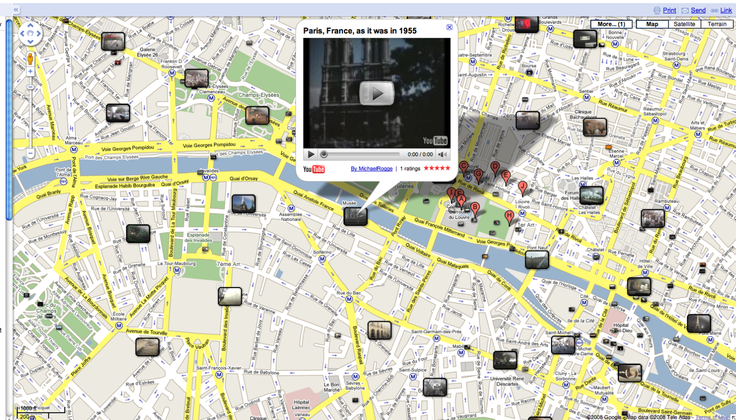
Google Sightseeing blog: View some of the great images from around the world
2. Earth Picker
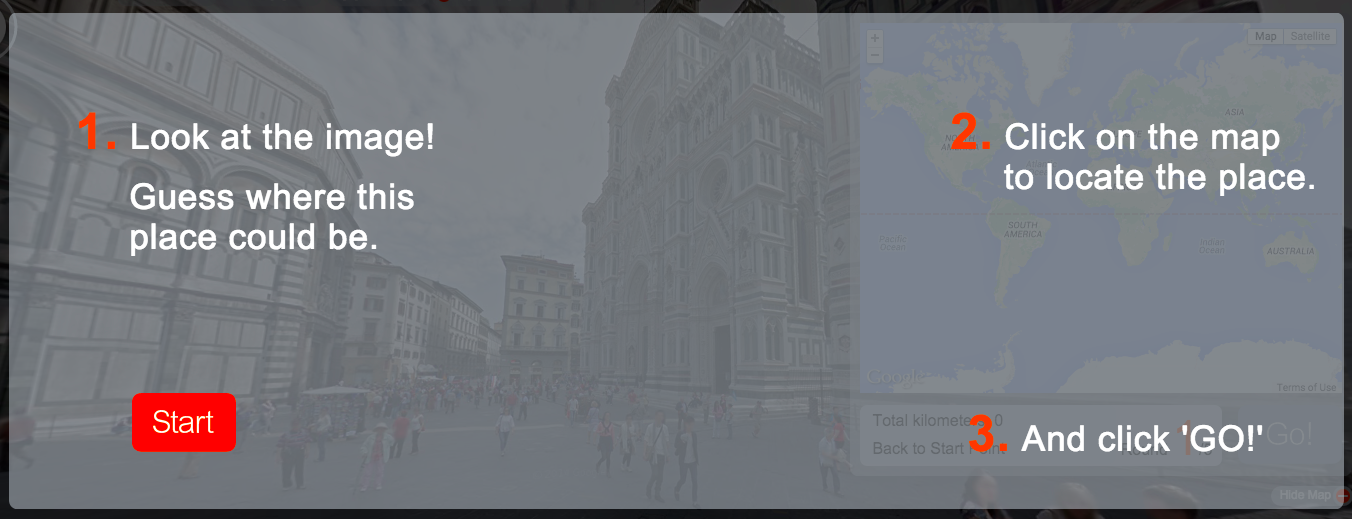 Earth Picker is a fun and addicting game. If you click on the link kiss the next 30 minutes of your life goodbye. The game reminds me a bit of Carmen Sandiego back in the day. Only in this game you need to be able to “read an image” a new skill that we need to be teaching students as more and more of our information becomes visual. What do you see? What clues can you find? A great little game to start teaching digital mapping skills.
Yes…Google does have a whole site dedicated to using maps in education
3. Smarty Pins
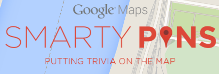 Smarty Pins is a great game for educators to use and adapt. I encourage educators to play the game for awhile, yes the questions seem to be American Centric, however what we’re after here is the questions that Google is asking and how the game works. Once you get the hang of it an educator could create their own questions around their own content area. Students could put a pin on the map where they think it is…once the true place is revealed they could get driving directions to see how far they were off….now we bring math into the curriculum and have students add and keep track of their own distances. Think settings of books in English class, battles in history class, or create questions in a world language class and the country practicing language skills. Yes the game is fun….even better is how easy it would be to adapt it to fit your curriculum.
4. My Maps
 My Maps is simply amazing. So much so that it is used in the next six ways to use Google Maps. My Maps allows you to create maps not just read and use them. All of a sudden we become digital map creators and the possibilities become endless.
5. Video Tour
 Using My Maps students could add markers along a route of say…..Ferdinand Magellan. Students could create videos, or record their voice and actually embed them into a marker for others to learn about what happened at that spot on his travels.
Now….because this is Google…..of course you can share a map just like you can a Google Doc. Now you have 10 students working on 10 different explorers all of them adding their routes and videos to the same map. From there we can start to see patterns of routes, patterns of where explorers were going and what they were trying to do. Now we can start asking questions and as we find answers to them we create videos and add more information back to the world.
6. Create a map for your community
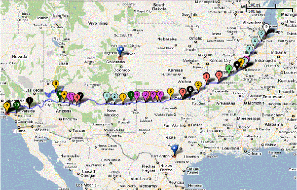
 My Maps isn’t new. In fact I’ve been creating maps for different purposes since about 2007! Here’s a map that I created for friends that came to visit while we lived in Shanghai, China from 2005 – 2008. Are you studying your community? Your country? Your state/province? Why not create a map for others based on your favorite places to eat, visit, play, etc.
See how others are using Google Maps to help their communities
7. Create a route
 We’re talking real skills here! Here’s a route I created when my wife and I visited Croatia last year. We had never been to Croatia before and didn’t know the roads or how long we should expect to drive between our destinations. Using My Maps we were able to create a route from hotel to hotel and get a really close approximation of the driving time we would have each day. So cool and digital maps has now forever changed the way you travel!
8. Measure Distance and Area
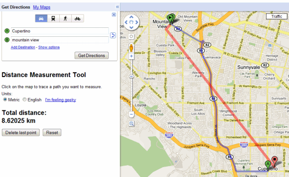 In My Maps you get the ability to draw straight lines to see the distance between two points anywhere in the world. Better yet is the ability to draw out an area. Ever wonder just how big Russia really is? What if you draw an area map around your country and then move that area over Russia. How many of your countries do you think fit in Russia? In China? On the continent of Africa?
9. See your World in 3D
 My Maps allows you to export your map in KML format. Funny….cause Google Earth allows you to import KML files to give you high resolution images of all your information in a 3D space. Expanding the conversation, expanding knowledge about our world…and beyond.
10. Mobile Maps
 Google Maps is downloadable on every mobile device I know of and My Maps is as well (Android, iOS)! So now you can create maps and use maps on your phone, tablet, watch? No need to have a class set of laptops when every students has a phone in their pocket. Here’s the problem…..this is number 10 and now that we have the ability to make and read maps on a mobile device that has GPS on it…..we just opened up a whole new way to engage with information, create information, and teach students the skills they’ll need for their future in a digital mapping world!
Yes…..paper maps days are numbered. Sure they’ll be around for awhile yet but really…that’s for our generations not theirs. They might never touch a paper map…never have to be frustrated with trying to fold it back up, worry about it ripping or whether or not it’s up to date. I know, I know….we loved our paper maps. But it’s time to let them go and embrace a new digital mapping world. For the sake of our students and their future.
Happy Birthday Google Maps….may you continue to lead me around our world!

Hey Mr. Utecht! My name is Chloe Hendricks and I am a student at the University of South Alabama. I’ve never even thought about using Google Maps in the classroom before. I use it about weekly but I’ve never considered it to be a learning resource. These are some awesome things you have listed here! These activities can range from early elementary school all the way up to high school. Younger children especially would be mind blown to be able to see a picture of their house or school on the computer right in front of them. The older students could really benefit from creating video tours or creating routes. The activities aren’t difficult by any means but I could see them being extremely rewarding to students.
Hi Jeff, thanks for this it was very helpful! I would suggest that you add Google Lit Trips to #7 or #5. http://www.googlelittrips.com/GoogleLit/Home.html
I’m having students design one for the novel “Peak”.
[…] At YIS, we’ve done this in lots of different ways, from our grade 7 students using their iPads as they move around the classroom and school, to taking them out on fieldtrips as they explore Yokohama, to taking advantage to all of the different ways to explore our world with Google Maps. […]
Hi Jeff Utecht. Thanks for opening my eyes to all the ways Google maps can be used in the classroom. My name is Tanya and I am an education major at the University of South Alabama in Mobile, Alabama. I can see with some thought, Google maps can become a powerful tool to almost any classroom assignment, whether the assignment is a group or individual. Maybe as a history lesson I should pull out the old paper maps and show the class what people used as maps in the “old days”. Thanks for the great referral. I enjoyed your post.
Thanks for the awesome ideas! I’m in a “Technology in the Classroom” class in grad school right now, and this stuff is blowing my mind! Can’t wait to use it with my students in the future!
I totally agree with you! Google maps can be fun to use and very educational.
Another great solution for creating custom, beautiful maps is http://www.mapme.com
[…] are scores of other ways to use Google Maps in your classroom. All you need to do is, get creative. Here’s […]
[…] blog post from 2010 shows several math maps examples, and Jeff Utecht’s blog post from 2015 lists 10 ideas for using Google Maps in your […]
[…] 10 Ways to Use Google Maps in the Classroom […]